 vesseltracker.com
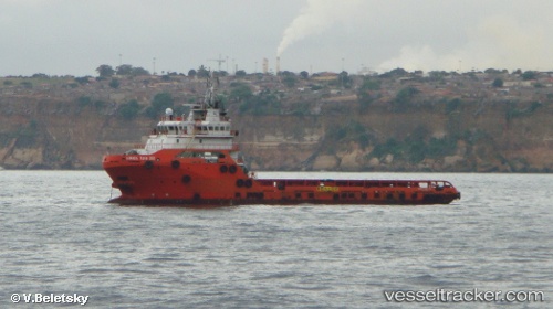
Vessel HAI DUONG 68 IMO: 9568665, MMSI: 574004520 Offshore Supply Ship
UTC, 11.85167, 97.02500, course: -1, speed: 5
UTC, 11.66500, 97.14167, course: -1, speed: 5
2026-02-21 11:34:34 UTC, 11.53667, 97.22167, course: -1, speed: 5
Live AIS position:
UTC. 93 nm S of Yetagun Field),
updated 2026-02-21 11:34:34 UTC.
Find the position of the vessel HAI DUONG 68 on the map. The latter are known coordinates and path.
marine traffic ship tracker show on live map
The current position of vessel HAI DUONG 68 is 11.53667 lat / 97.22167 lng. Updated: 2026-02-21 11:34:34 UTCCurrently sailing under the flag of Vietnam
HAI DUONG 68 built in 2012 year
Deadweight:
3284 tDetails:
Last coordinates of the vessel:
UTC, 12.03333, 96.91833, course: -1, speed: 6UTC, 11.85167, 97.02500, course: -1, speed: 5
UTC, 11.66500, 97.14167, course: -1, speed: 5
2026-02-21 11:34:34 UTC, 11.53667, 97.22167, course: -1, speed: 5